You are here:Home-administrator

About administrator

This author has not yet filled in any details.
So far administrator has created 84 blog entries.

Worksite Triage Forms

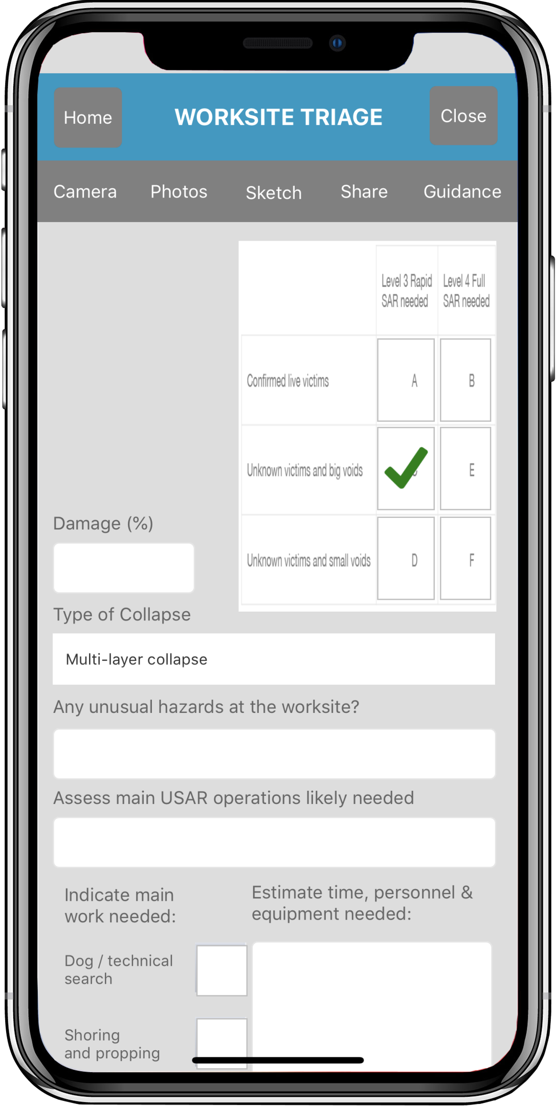
The Worksite Triage forms help gather preliminary data during initial review of a disaster worksite. The forms comply with United Nations INSARAG worksite triage forms. The home screen for your worksite forms displays a checkbox to indicate which forms to upload when the 'Upload' button is

By |2017-09-16T20:05:09-07:00September 16th, 2017|Categories: Android, Apple, Apps|Comments Off on Worksite Triage Forms

FEMA Waypoints and Tracking sets

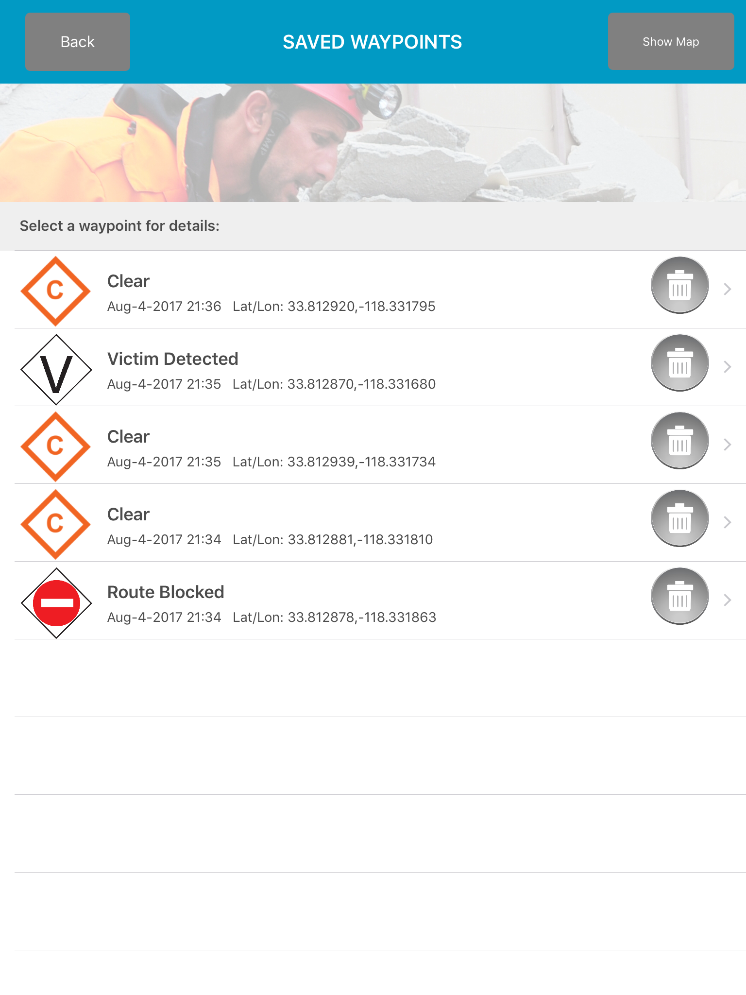
Disaster Surveyor has incorporated the most comprehensive set of GPS marker icons as utilized by both the United Nations INSARAG teams and the U.S. FEMA GPS marker sets. As a search and rescue worker begins his route, an automated Tracker can be set with increments of 1, 5, 10, 15, 30,

By |2017-08-05T10:59:02-07:00August 5th, 2017|Categories: Android, Apple, Apps, Featured, News, Uncategorized|Comments Off on FEMA Waypoints and Tracking sets

Team collaboration

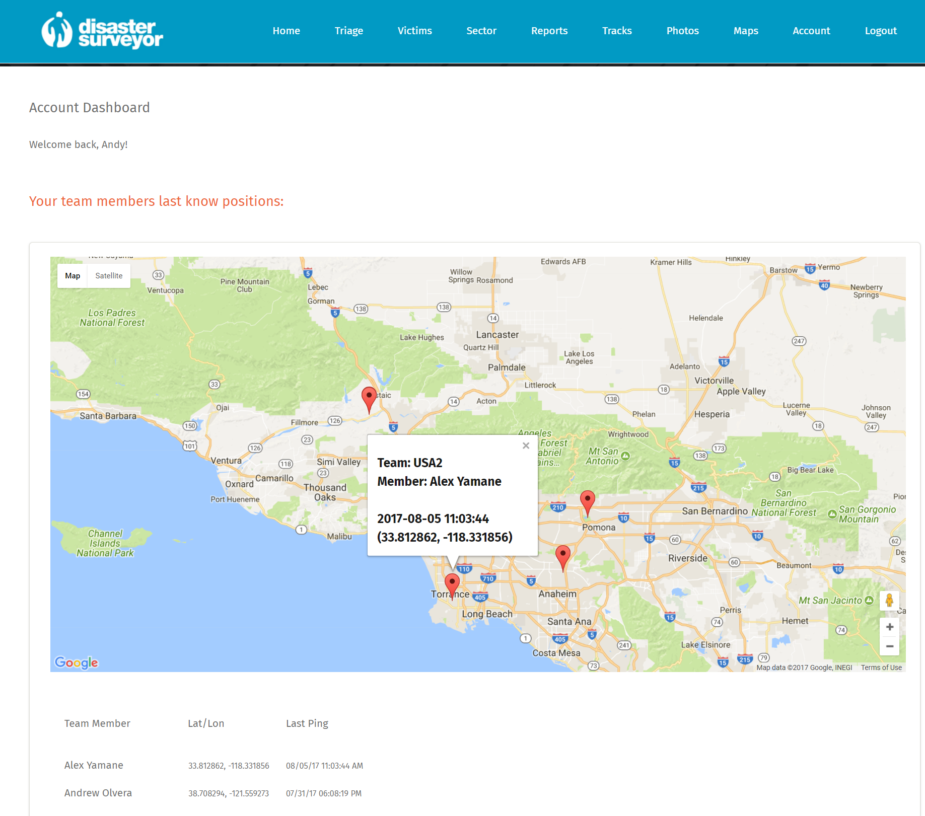
Disaster Survey has been designed to work with multiple team groups with a central management tool for any adhoc emergency Base of Operations or coordination cell. Each team member assigned to a particular team ID are grouped together and an operation commander may again instant situational aware from all team members

By |2017-08-05T10:53:49-07:00August 5th, 2017|Categories: Android, Apple, Apps, Featured, News|Comments Off on Team collaboration

Offline Maps and Photos

Disaster Surveyor allows saved reference pdf maps to be used in conjunction with data collection efforts while making initial worksite assessments. For emergencies when referenced maps are not yet available, a Google Maps feature allows for finding a general map of the area, to be saved as a pdf to be used offline in the

By |2016-08-30T22:31:45-07:00August 30th, 2016|Categories: Apps, Featured, Gadgets, Hardware, News, Photography, Reviews, Tutorials, Uncategorized|Comments Off on Offline Maps and Photos

Offline Maps and Photos

Disaster Surveyor allows saved reference pdf maps to be used in conjunction with data collection efforts while making initial worksite assessments. For emergencies when referenced maps are not yet available, a Google Maps feature allows for finding a general map of the area, to be saved as a pdf to be used offline in the

By |2016-08-30T22:30:53-07:00August 30th, 2016|Categories: Apps, Featured, Gadgets, Hardware, News, Reviews, Tutorials, Uncategorized|Comments Off on Offline Maps and Photos

Offline Maps and Photos

Disaster Surveyor allows saved reference pdf maps to be used in conjunction with data collection efforts while making initial worksite assessments. For emergencies when referenced maps are not yet available, a Google Maps feature allows for finding a general map of the area, to be saved as a pdf to be used offline in the

By |2016-08-30T22:26:20-07:00August 30th, 2016|Categories: Featured, Gadgets, Hardware, News, Reviews, Tutorials, Uncategorized|Comments Off on Offline Maps and Photos

Existing INSARAG Forms

Disaster Surveyor uses existing and widely adopted INSARAG worksite triage, victim extrication, sector assessment and worksite report forms to full compatibility with existing worldwide systems.   "In eu ultricies lacus. Phasellus non ante nec neque imperdiet congue. Donec sed lectus eu mi tincidunt rhoncus non a metus. In hac habitasse platea dictumst"

By |2016-08-01T16:49:11-07:00August 1st, 2016|Categories: Featured, News, Tutorials|Tags: , , , |Comments Off on Existing INSARAG Forms
Go to Top